Pingxi Railway Slope Collapse Early Warning and Tech Inspection Recovery
Construction methods · Smart operations · AEC industry
Taiwan Railway's Yilan Division and CECI established tech-based slope inspection and early warnings for the Pingxi Line. Combining UAV-LiDAR, SLAM, and foot patrols overcame canopy cover to map fissures. Data showed 68% of failures occurred in winter non-flood periods. A two-stage piling method was executed at K2 and K9 sections, with automated tiltmeters deployed to verify long-term stability.
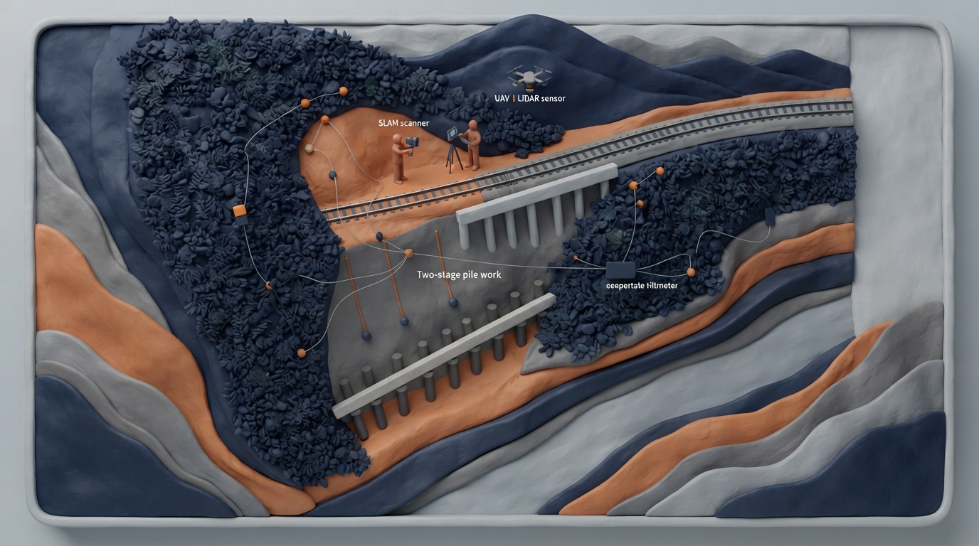
The Pingxi Line of Taiwan Railway is a 12.9-kilometer single-track non-electrified branch line characterized by steep alternating sandstone-shale formations alongside the Keelung River valley. Faced with aging infrastructure and intense precipitation, torrential rains in October 2025 caused 10 major slope failures, disrupting operations due to subgrade loss at sections including K1+965 and K9+820. In response, Taiwan Railway's Yilan Division collaborated with engineering teams to deploy UAV-LiDAR and handheld SLAM-LiDAR scanning. This approach overcame dense vegetation to build centimeter-level digital elevation models, identifying subtle fissures that traditional manual surveys could not easily reach. Historical analysis of 67 slope hazard sites recorded between October 2021 and April 2026 revealed that 68% of incidents clustered during the winter non-flood months (October to February) driven by the northeast monsoon. A three-tier risk management framework was established: Level 1 high-risk zones (such as K1 and K9 sections with past trackbed loss) received priority remediation and automated year-round monitoring; Level 2 zones undergo semi-annual UAV photogrammetry tracking and intensified seasonal patrols. To achieve operational reopening before the 2026 Lunar New Year under severe site constraints, remediation was phased top-down. The initial phase installed cantilever pile retaining structures using auger drilling and H-beam reinforcements alongside tracks to stabilize subgrades for early resumption of train traffic. The subsequent phase introduced multi-tier retaining piles and tie beams along the lower toe slope to curb progressive deep slip surfaces. Automated wireless tiltmeters installed on the structures demonstrated stable angular trends below action thresholds, demonstrating a viable framework for mountain railway preventive maintenance.
Key takeaways
- UAV-LiDAR, handheld SLAM scanning, and on-site pedestrian geological inspections were integrated to overcome dense vegetation canopy and map tension cracks at centimeter-scale resolution.
- An evaluation of 67 hazard locations from 2021 to 2026 showed 68% of slope incidents occurred during the winter non-flood period (October to February), prompting a three-tier risk classification system.
- Emergency rehabilitation implemented a two-stage top-down piling scheme, placing cantilever drilled piles near tracks first for swift train reopening, followed by lower-slope tie beams against deep sliding.
- Automated wireless tiltmeters were deployed along critical retaining structures to verify continuous structural rigidity and long-term slope stability.
Source:中國土木水利工程學會|土木水利 Read the original ↗
Prepared, checked and automatically published by AI; not individually reviewed by a human. Translation checked by AI.