Investigation and Evaluation of Debris Flow Inundation on Road and Rail at Dachingshui River
Project management · AEC industry
This study integrates multi-temporal remote sensing, topographic scour-deposition quantification, and SRH-2D hydraulic modeling to analyze the debris flow disaster inundating the TRA North-Link Line and Provincial Highway 9D at Dachingshui River in Hualien. A massive boulder upstream of Qingshui Bridge constricted about 30% of the floodway section, causing backwater, while inertial flows downstream struck the railway bridge abutment. Simulations confirm mitigation works lower flood risks.
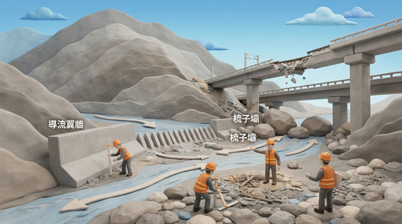
Researchers from the Disaster Prevention and Water Environment Research Center at National Yang Ming Chiao Tung University conducted an emergency investigation into the debris flow at Dachingshui River in Hualien. Triggered by short-duration intense rainfall mobilizing post-earthquake sediment, debris flow inundated Provincial Highway 9D Qingshui Bridge and the TRA North-Link Line bridge, damaging infrastructure and halting train services. Using multi-temporal imaging and SRH-2D modeling, the investigation identified that an upstream 265 m³ boulder weighing around 700 metric tons constricted 30% of the cross-section under Qingshui Bridge. Downstream inertial flows subsequently struck the TRA West-Track left abutment, depositing sediment that overtopped the tracks. Simulations indicate that rehabilitation works completed in December 2025—including guide training walls, check dams, boulder removal, and channel dredging—effectively divert the main flow and reduce local water levels to prevent re-inundation.
Key takeaways
- Remote sensing and hydraulic analysis showed a 700-metric-ton boulder upstream of Qingshui Bridge constricted about 30% of the cross-section, causing overtopping and direct impact on the TRA bridge abutment.
- Topographic analysis indicated approximately 50,000 m³ of deposition within 400 meters upstream of the check dam and 60,000 m³ of potential source material along adjacent gullies.
- SRH-2D simulations demonstrated that mitigation combined with boulder removal lowers water levels by approximately 2.5 meters at Qingshui Bridge and training walls reduce left-bank levels by 1.5 meters at the railway bridge.
- The authors recommend cross-agency collaborative management covering monitoring, early warning, regular dredging, and reinforcement against boulder impact and abrasion.
Source:中國土木水利工程學會|土木水利 Read the original ↗
Prepared, checked and automatically published by AI; not individually reviewed by a human. Translation checked by AI.